What if you could study a landslide near Ramban, a swollen river in the Chenab belt or a change in Jammu's forest cover without waiting for a cloud-free photograph?
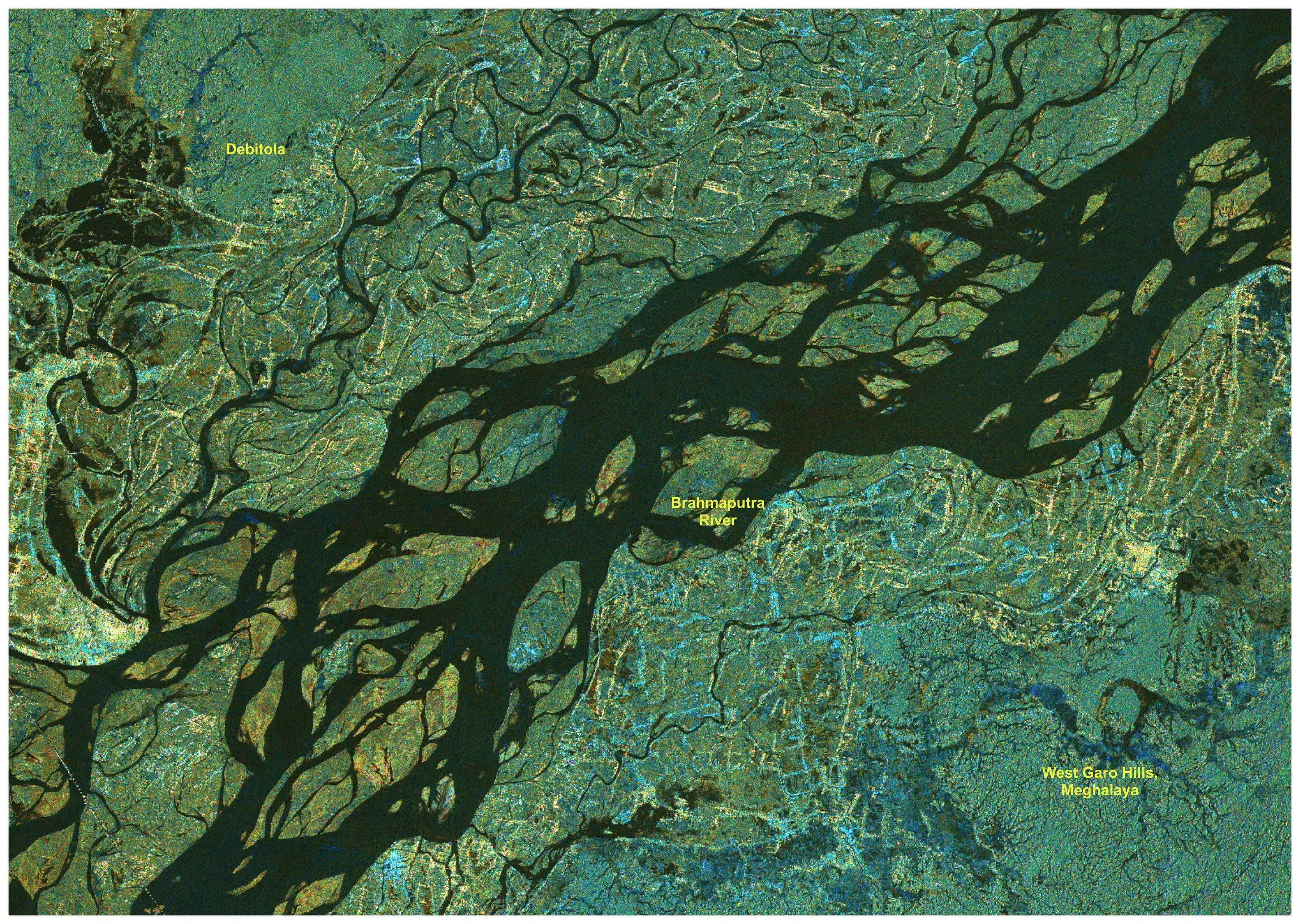
That is the practical promise behind a quiet update from ISRO. On 24 July 2026, the space agency said it had begun releasing processed S-band radar data from NISAR through Bhoonidhi, its earth-observation data portal. The release covers Indian land areas as well as selected global locations, and it gives students and researchers a new stream of real satellite observations to work with.
What NISAR sees differently
NISAR is the joint NASA-ISRO Synthetic Aperture Radar mission. Unlike an ordinary camera, radar sends out microwave signals and reads the return. That means it can observe the ground through cloud and at night — useful conditions in a Himalayan monsoon, where the most important change may happen precisely when optical imagery is hardest to get.
The satellite carries both L-band and S-band radar. ISRO's latest release is for the S-band side. The mission uses a 12-metre reflector, observes a swath roughly 240 kilometres wide and is designed to revisit the same ground on a 12-day cycle. That repeat view is what makes change detection possible: compare one pass with the next and small shifts in land, water or vegetation begin to show.
What has actually been released
ISRO says S-band products from Cycle 25 onward are being generated in its operational system and made available through Bhoonidhi. Cycle 25 began on 8 July 2026. Older acquisitions will be reprocessed in phases and added to the archive later.
This is not a one-off gallery of satellite pictures. It is a growing data series. That distinction matters if you want to build a college project, dissertation or mapping tool that needs more than a single before-and-after image.
Why Jammu is not a forced angle
J&K is already one of the places where satellite data is used for flood mapping, landslide assessment, forest-fire response, agriculture and planning. In a March parliamentary reply, the Department of Space pointed to customised forest-fire monitoring, disaster information through Bhuvan and the National Database for Emergency Management, and ISRO's continuing work with the J&K Remote Sensing Application Centre.
The same official reply also named the Satish Dhawan Centre for Space Sciences at Central University of Jammu as part of the region's space-technology ecosystem. In other words, the local route is not hypothetical: Jammu already has an institution meant to connect students and researchers with this work.
NISAR adds a richer radar layer to that toolkit. A realistic Jammu project could examine:
slope movement and landslide-prone stretches in Ramban, Doda or Kishtwar;
seasonal shifts in the Tawi, Chenab and their floodplains;
forest and soil-moisture change around the Shivaliks;
crop patterns and water stress in the plains of Jammu, Samba and Kathua;
ground movement near roads, tunnels, bridges or large construction sites.
What a student can do this semester
Start small. Open Bhoonidhi, create an account if the download asks for one, and search the NISAR collections for a place you already understand. Geography and environmental-science students can begin with visual change maps. Civil-engineering students can frame a slope or infrastructure question. Computer-science students can build classification or alerting prototypes around a labelled set of scenes.
You will still need GIS and radar-processing skills. A false-colour SAR image is not a photograph, and bright or dark patches do not explain themselves. QGIS is a sensible entry point; more advanced interferometric work needs specialist tools, careful calibration and field validation.
The honest limit
This release does not mean Jammu now has a public, neighbourhood-level landslide warning app. It means the raw material for better research and future systems is becoming available. Turning radar data into a trustworthy warning requires terrain models, rainfall and soil information, repeated observations and people who know the ground.
That is exactly why the student opportunity is interesting. The hard problem is no longer getting any satellite data at all. It is asking a local question precise enough to make the data useful.
%2Fgreater-kashmir%2Fmedia%2Fmedia_files%2Fwp-content%2Fuploads%2F2025%2F10%2Fclassroom-pic.jpg&w=3840&q=75)